
About Village
This village is located in Ambalathara town which is 8 kilometer from Arabian Sea. 5 kilometer from MIni civil station Hodurg and 4 Kilometer from Mavungal Junction. This Village Contains Hilly area and valleys.
Demography
Ambalathara village is situated in Teshil Hosdurg, District Kasaragod and in State of KERALA India. Village has population of 9120 as per census data of 2011, in which male population is 4268 and female population is 4852. Total geographical area of Ambalathara village is 2522 Hectares. Population density of Ambalathara is 4 persons per Hectares. Total number of house hold in village is 2217.
Geography
AMBALATHARA Village MADIKKAI Panchayat KANHANGAD is situated in Kasaragod District. People of this village are living in very peaceful manner. This village having very proud history. Agriculture is the main profession of this village. Still this village is waiting for Industrial development. Education, Drinking water, Road and Electricity are the main concern of this village. Young generation is more attracted towards mobile, Laptop and computer technology these days. If banks and finance institutions proved loan and other financial support to the villagers, this village will see the real development. Medical and health services has to be improved.
Socio-Economic
Ambalathara is a small Village/hamlet in Kanhangad Block in Kasaragod District of Kerala State, India. It comes under Periya Panchayath. It belongs to North Kerala Division . It is located 26 KM towards South from District head quarters Kasaragod. 2 KM from Kanhangad. 556 KM from State capital Thiruvananthapuram
Ecology
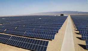
Solar energy represents a fossil fuel alternative to meet India’s rising energy demand. Large mega-watt solar projects require contiguous land, which is sparse in the South Indian state of Kerala. Drawing from ethnographic research in Kerala, this paper traces the role that solar infrastructure plays in making and unmaking land and lives in pursuit of light. Government officials promoted the Kasaragod solar park and associated green corridor transmission line as climate-friendly infrastructure development for the energy deficit state. Select government officials encouraged solar projects as the renewable resource would help, “lead the district into the light.” Although the energy infrastructure promoters promised development benefits for local stakeholders, Adivasis (indigenous peoples) without legal land titles and others opposed the acquisition of their land for the solar project. The Kasaragod Solar Park exemplifies how national climate goals for renewable energy and empty infrastructure pledges translated into the reification of land unevenness, with particularly profound implications for Adivasis. This reproduction of socio-environmental injustices did not go unchallenged. Local political opposition significantly reduced the 200 Megawatt (MW) solar park to 50 MW, but not before some Adivasis and others without land titles lost their land and livelihoods. This case illustrates how the completion of renewable energy infrastructure to meet national and state climate goals may hinge on the assertion of local political power to thwart or promote large-scale projects. Efforts to pursue ambitious national renewable energy infrastructure goals without recognition of historical land and development unevenness may hinder India’s capacity to pursue renewable energy transition goals.
Tourism
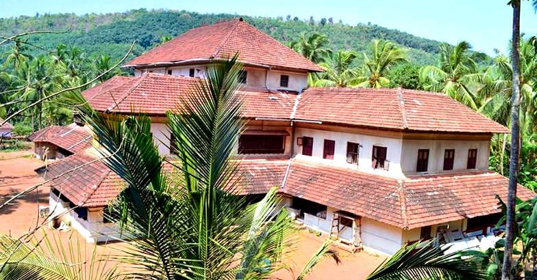
ACHIKKANAM THARAVAD , SOLAR PARK VELLOODA