About Village
Village established in 1955. Migration,settlement and habitation of the village started in South Kottappady in 1800s. The name Kottappady is associated with Thzhassery fort Lords who were connected with the Lord Cheranelloor. The word Kottappady was derived from the words Kotta(fort) and Pady (step). Until the conquest of north by Marthandavarma, the fort was ruled by lords with royal powers. The northern part of the village is completely covered with Kottppara forst reserve. Eastern part of Pindimana village in the north east, Thrikkaryoor village in the South, some parts of Thrikkaryoor village in the south east, Vengoor Village in the West and some part of Asamannoor Village in the south west. The village extends Six kilometers length to the north south direction and eight kilometres in width to the east west direction. Government and semi govt institutions in the Village are 1.Village Office, Kottappady, 2. Grama Panchayath Office, Kottappady, 3.Govt. Ayurveda Dispensary Kottappady, 4. Govt. Homeo Dispensary, e, Kottappady, 10. Govt. Veterinary Hospital Kottappady Bank: 1. State Bank of India, Kottappady. 2.The Federal Bank Ltd, Kottappady, 3. Kerala Bank, Kottappady., 4. Service Co operative bank, Kottappady, 5. Service Co operative bank, Uppukandam., Educational institutions: 1. North LP School, Kottappady, 2. South LP School, Kottappady, 3. AGCM, UP School, Uppukandam, 4. LP School, Muttathupara, 5.Mar Elias High School, Kottappady, 6. Mar Elias Higher secondary School, Kottappady, 7. Mar Elias College, Kottappady, Parliament constituency : Idukki, Assembly constituency : Kothamangalam, Block Panchayath : Kothamangalam, Block Panchayath Division: 1. Kottappady, 2. Pindimana, District Panchayath Division : Kottappady, Gramapanchayath : Kottappady,
Demography
Population as per census 1991 is17903; Male : 8935 Female: 8968
Geography
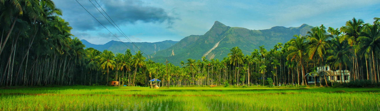
Area: 2783 Hr 41 Are 88. Sqmt. Kottappady Village is made up of small hills and valleys. According to topography , it belongs to Edanadu region(intermediate zone) slightly sloping towards west from east.The northern part is slightly elevated and covered with Kottappara Forest reserve. The south western part of the Village is hilly region. Small streams flow west through the valleys. Three times growing paddy fields are common in areas irrigated by Periyar Valley canals. The hills largely become Rubber plantations.
Socio-Economic
The economic structure mainly dependent on agriculture. Rubber, coconut, paddy, cocoa, arecanut are the main crops. Lots of people as a sub occupation raising cow for milk production. Farmers in the hilly region of this village are not able to cultivate profitably due to continuous crop menace by wild elephants.
Ecology
Village is made up of hills, slopes, vallleys, and streams (trenches). Soil category commonly belongs to laterite soil. Kodinjamkuzhy kunnu, Kallumalathandu, Kottapparamudi are the important hills in the village. Naganchery Thzhathe padam, Moonnamthodupadam, Plamudypadam, Cheranganalpuncha, Chelakkappilly padam, Virippakkattu padam, pookkottupadam, are the important paddy fields. Arachira, Virippakkattuchira, Uppukandamchira, Kuttamkulam chira, Kalayamkulam, Malikakkulam, Poochakkulam, Pongalikkulam, and Placherikkulam are the important ponds and water gauges in the Village.