About Village
Upputhara village is located in Peerumade Tehsil of Idukki district in Kerala, India. It is situated 30km away from sub-district headquarter Peermade and 56km away from district headquarter Painavu
Demography
The panchayat comprises an area of 135 km2. As of 2001 India census, Upputhara had a population of 20596 with 10292 males and 10304 females.[1] Scheduled castes formed about 15 percent of the population in that year. There was a sizeable population of Catholic Christians in the panchayat who played a major role in its social life.
Geography
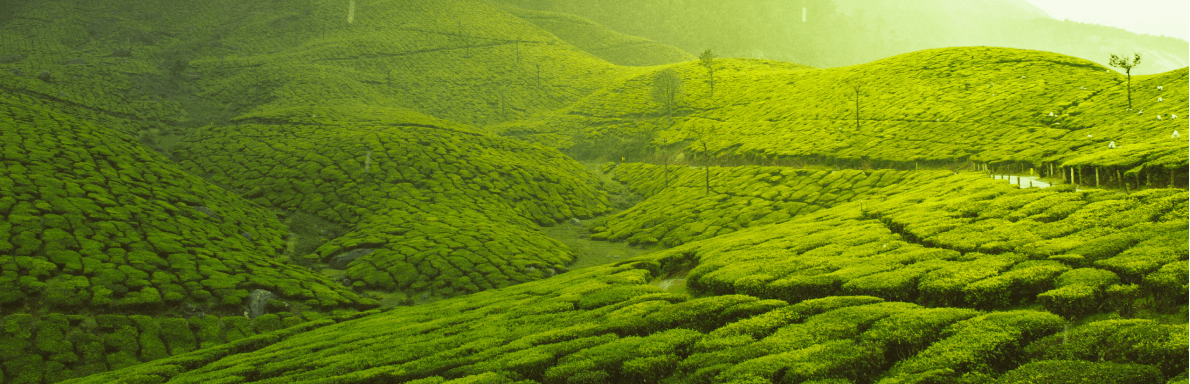
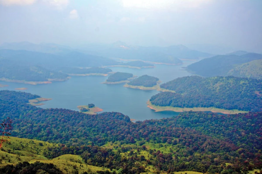
The total geographical area of village is 3598 hectares.The panchayat is bordered by the Periyar River in the east, the Meenmutti Lake in the west, the Chinnar River and the Karintharuvi River in the south and the Kakkathode protected forests in the north.
Socio-Economic
The entire region around Upputhara remained uninhabited till about the early part of the 20th century. Upputhara was one of the regions to which migration of farmers from other parts of Kerala = took place. A group of seven Christian households came to Upputhara in 1910 from the Meenachil taluk of Kottayam district after acquiring licence from the Government of Travancore to establish tea plantations. The first migration to begin cultivation of crops outside the plantation segment took place, however, only later by the mid-1930s. This type of migration to regions outside the plantation segment was mainly steered by a policy of the Government of Travancore to distribute pattas (possession rights) to migrant farmers in previously uninhabited areas. The largest flow of migrants into Upputhara and its surrounding regions took place in the 1950s.
Ecology
Geographically, Upputhara is divided into six types of land forms; mountains, highly steep land, moderately steep land, valleys, marshy lands and rocky lands. Of these six land forms, about 40 percent of the total area is classified under valleys. Next in importance are marshy lands, slightly steep land, mountains, very steep land and rocky lands, in that order. Valleys and marshy lands together accounted for 62 percent of the area.
Tourism
Memari Kannampady is a remote tribal settlement of Idukki District, which is situated inside the dense forest of Idukki Wild Life Sanctuary. The nearest town to Kannampady, Upputhara is about 20 km from here. There are about eight tribal settlement areas in Kannampady. the farthest of which is Memari, about 8 km away from Kannampady